Trekking Around Bariloche: Nahuel Huapi National Park Trails
Book an experience
Guided treks & hikes
Book a guided trek: gear, route knowledge, and safety handled by experienced local guides.
Bariloche occupies a different position in Argentine trekking compared to the southern Patagonian destinations of El Chaltén and El Calafate. Where those centres offer raw, remote wilderness accessible to fit but non-technical hikers, Bariloche sits within Nahuel Huapi National Park - a more established park infrastructure that predates Los Glaciares by several years, with a tradition of mountain hut (refugio) networks, well-marked trails, and a broader range of terrain types.
The result is a trekking destination that suits a wider range of experience levels and provides more route options for multi-day walking without camping gear.
Nahuel Huapi National Park
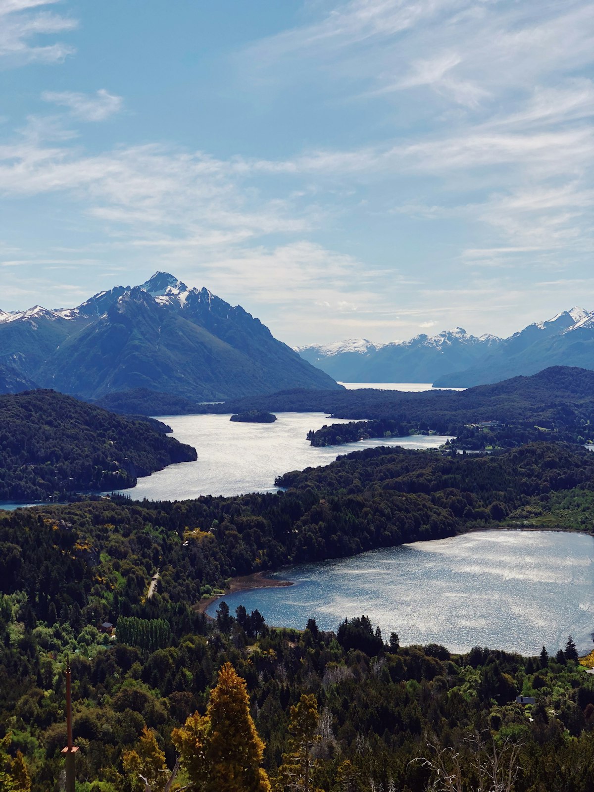
Nahuel Huapi was established in 1934, making it the first national park in Argentina. It covers around 700,000 hectares in the Río Negro and Neuquén provinces, centred on Lake Nahuel Huapi - a 557km² glacier-carved lake with a complex shoreline of bays, peninsulas, and islands. The park encompasses alpine zones above 2,000 metres, temperate Valdivian rainforest on the Chilean-facing slopes, and drier steppe on the eastern side.
The city of Bariloche (officially San Carlos de Bariloche) sits on the southern shore of the lake at 770 metres above sea level and serves as the park’s main gateway. The Club Andino Bariloche, the mountaineering club that maintains trails and refugios throughout the park, has its office in the city and is the primary source of current trail conditions.
Key Day Hikes
Cerro Campanario - 3.5km round trip, 250m gain, 1.5–2 hours. A short, steep trail ending at a viewpoint frequently cited as one of the most photogenic in the Lake District: a 360-degree panorama over Lago Nahuel Huapi and the peaks beyond. There is also a chairlift to the summit for those who prefer not to hike. Best done early morning before clouds develop.
Cerro Otto - 8km round trip, 800m gain, 4–5 hours from the city edge. A more substantial hike than Campanario, with excellent views north over the lake and south toward Cerro Catedral. The summit has a revolving restaurant (reached also by cable car). The trail passes through forest before opening to rocky upper slopes.
Cerro Catedral Base Trail - variable distance. Cerro Catedral is the main ski resort south of Bariloche and in summer becomes a trekking destination. The base lifts operate in summer as a trekking aid, giving access to the 1,600-metre level from which trails extend to higher zones. The area above the lift access is rocky, exposed alpine terrain.
Laguna Verde and Laguna Los Cántaros - from Cerro Catedral base, accessible via trail. The two small glacial lakes at altitude offer reflections of the surrounding peaks and are less visited than the main Campanario/Otto viewpoints.
Filo de los Contrafuertes - from Pampa Linda, 15km round trip, 6–7 hours. Pampa Linda is a valley in the southern part of the park, accessible by bus from Bariloche (seasonal service). The trail climbs through beech forest to an exposed ridge with views toward Monte Tronador and the Argentine-Chilean border glaciers.
Multi-Day Routes
The Refugio Loop (Paso de las Nubes) - a 2–4 day route connecting the refugios of Neumeyer, Laguna Negra, and others in the circuit south and east of Bariloche. Each night in a refugio (with meals) is paid; advance booking is essential in December and January. This route passes through varied terrain - forest, alpine meadow, scree - and is well-suited to hikers with moderate experience.
Tronador Circuit - based at Pampa Linda, this 3–4 day route accesses the glaciers on the slopes of Monte Tronador (3,470m), the highest peak in Nahuel Huapi. The mountain straddles the Argentine-Chilean border; the Argentine side has accessible glaciers visible from the trail. This route involves some glacier terrain and is best done with a guide or with glacier travel experience.
Traverse routes - longer traverses crossing the park from south to north or east to west are possible with multi-week time and full camping gear; these require serious navigation skills and experience with mountain weather.
Practical Notes
Club Andino Bariloche maintains an office on Calle 20 de Febrero in the city centre. They sell detailed topographic maps of the park, provide weather forecasts, and advise on current trail and refugio conditions. Always check conditions here before a multi-day route.
Weather: Bariloche receives more rainfall than southern Patagonia because it sits closer to the Chilean coast. The lake district microclimate means rain can arrive from the west at any time of year. The wind is less extreme than in El Chaltén, but the rain is more consistent.
Access to trailheads: Many day hike trailheads can be reached by public bus from Bariloche. The No. 10 bus serves Cerro Catedral; other routes serve different zones. A rental car or remise expands options significantly.
Gear: Similar to all Patagonian trekking - waterproof layers are non-negotiable. Hiking poles are helpful on the steeper trails. The terrain is generally better-maintained and less technically demanding than Los Glaciares trails, but the weather requires the same preparation.
Guided trekking tours in Bariloche are available for those who prefer a local guide for the multi-day refugio circuits or the more technical Tronador approaches.
See also: Bariloche travel guide · Trekking around Bariloche - city-sub guide · Skiing at Cerro Catedral · Patagonia trekking guide · San Martín de los Andes travel guide
Frequently Asked Questions
- Do you need a guide to trek in Nahuel Huapi National Park?
- No guide is required for marked trails. The Bariloche park office (Club Andino Bariloche) provides trail maps, conditions updates, and route guidance. Many trails have clear signage and fixed refugios. Guides are recommended for technical routes and winter mountaineering.
- When is the best time to hike around Bariloche?
- November to April is the main trekking season. December to February offers the warmest conditions and the longest daylight hours. Autumn (March–April) brings dramatic beech forest colour. Some high-elevation routes are accessible in winter only with mountaineering equipment.
- What are the refugios in Nahuel Huapi?
- Refugios are mountain huts operated by Club Andino Bariloche along multi-day trekking routes. They provide basic dormitory accommodation and meals. Most require advance reservation, particularly in peak season. They make multi-day trekking accessible without carrying a full camping load.
Ready to explore?
Browse hundreds of tours and activities. Book securely with free cancellation on most options.
Browse on GetYourGuide →Best price guaranteed: same price as booking direct. We earn a small commission at no extra cost to you.