Trekking Around Bariloche
Book an experience
Top-rated experiences in Bariloche Travel Guide
The highest-rated tours and activities in Bariloche Travel Guide. Book today, cancel free if plans change.
Nahuel Huapi National Park surrounds Bariloche with over two million hectares of Andean-Patagonian forest, lakes, rivers, and glaciated peaks. The trail network ranges from half-day walks accessible without special equipment to multi-day circuits requiring camping or refugio (mountain hut) stays.
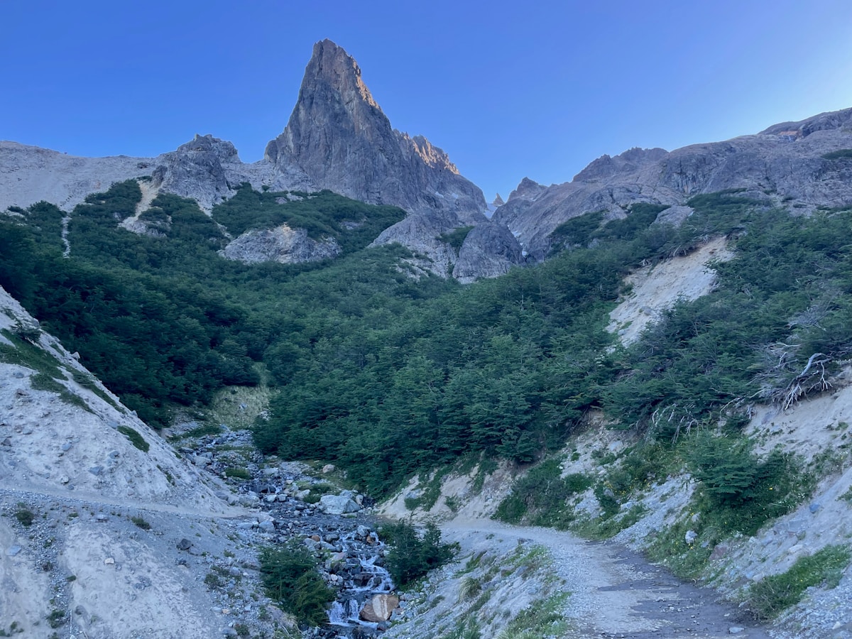
The landscape is shaped by the lenga and ñire beech forests (which turn red and gold in April), the deeply blue Nahuel Huapi lake and its smaller companions, and the rocky peaks above the treeline. It is a different character from the more austere Patagonian steppe - greener, more forested, and with a Northern European mountain feel that reflects the terrain’s similarity to the Alps and Pyrenees.
Planning and Information
The Club Andino Bariloche (CAB) on Morales Street in town is the essential first stop. They have current trail conditions, maps for sale, refugio booking, and staff who can advise on routes relative to your experience level. The national park service (APN) office nearby provides official park information. For those new to the area, guided tours in Bariloche can cover the most rewarding trails with a local guide handling navigation and logistics.
Download or buy the CAB map before heading into the park. Mobile signal is limited on most trails.
Day Hikes
Cerro Campanario (1,049m) - The cable car reaches the summit in 4 minutes, but the trail from the base takes 2–3 hours round trip. Excellent panoramic views over Nahuel Huapi lake. Suitable for all fitness levels on the cable car; the hiking route is moderate.
Piedras Blancas (1,400m) - A well-marked trail from the Llao Llao area leading through lenga beech forest to open terrain with views over multiple lakes. About 4 hours return. Moderate difficulty.
Cerro Carbón - Accessible from Colonia Suiza (reachable by bus from Bariloche). A half-day hike with good lake views and forest walking. Relatively easy.
Cascada de los Alerces - A short, flat walk near the road on the Circuito Chico route, leading to a waterfall through a forest of mature arrayán trees. Suitable for all levels; 1–2 hours.
Cerro López and Refugio López (1,620m)
One of the most rewarding single-day hikes from Bariloche. The trail climbs from the road above Villa Mitre through forest and into open rocky terrain to Refugio López at 1,620m, with sweeping views over Nahuel Huapi and the surrounding peaks. The refugio serves food and offers overnight accommodation.
Distance/time: 4–6 hours return from the trailhead (reached by taxi or bus from town). Elevation gain approximately 900m. Moderate to challenging.
Overnight option: Staying at Refugio López and walking to the Cerro López summit (2,076m) the following morning is a popular two-day trip.
Refugio Frey Circuit
The Refugio Frey circuit is the most classic multi-day trek from Bariloche. The refugio sits at 1,700m beside Laguna Toncek, surrounded by granite towers that are also used for technical rock climbing. The approach takes 3–4 hours from the Villa Catedral base area at the Cerro Catedral ski resort.
The standard route: Approach to Frey on day one; a high traverse via Paso del Vutre to Refugio Jakob (4–6 hours, requires some route-finding); return to Bariloche via the Mascardi Valley on day three.
Booking Refugio Frey: The refugio has dormitory beds and camping. Reserve in advance for January and February - the circuit is popular and spaces fill. Book directly through Club Andino Bariloche.
Difficulty: Moderate to challenging. Some sections of the Frey–Jakob traverse are on loose rock above steep terrain and require care. Not technical, but experience with mountain terrain is helpful.
Cerro Tronador (3,478m)
Tronador is the highest peak accessible from Bariloche, an extinct volcano with hanging glaciers and the Ventisquero Negro (Black Glacier) accessible as a day trip by car. The black colour of the glacier comes from volcanic rock dust in the ice.
Day trip: Drive the 85 km from Bariloche (paved road to Pampa Linda, then unpaved) to view the glacier from the car park. The walk to the glacier viewpoint is 30 minutes and easy. This is entirely accessible without climbing experience.
Paso de las Nubes: A multi-day route crossing from Pampa Linda over a pass and descending to the Lake District town of Peulla in Chile. This is a serious undertaking requiring a guide and advance planning - not a casual hike.
Autumn Trekking (April–May)
April is underrated for trekking around Bariloche. The lenga beech forests turn vivid shades of red, orange, and gold. Crowds are significantly thinner than summer. The main concern is day length - nights draw in from 6pm by late April - and the possibility of early snow on higher routes.
Essential Gear
- Good waterproof jacket (Patagonian weather changes fast)
- Broken-in boots with ankle support
- Sunscreen (UV is intense at altitude)
- Map (don’t rely on phone GPS - signal is limited)
- Food and water for the day - few trails have reliable water sources at lower elevations
- Layers: mornings can be cold even in summer
See also: Bariloche travel guide · Skiing at Cerro Catedral · Things to do in Bariloche · Patagonia trekking guide · Bariloche trekking routes
Frequently Asked Questions
- Do I need a permit to trek in Nahuel Huapi National Park?
- Most trails in Nahuel Huapi do not require a permit for day hiking. For multi-day routes staying in refugios, you pay the refugio fee directly. The national park entrance fee applies for some access points. Check with the park office (APN) in Bariloche before setting out.
- When is the best season for trekking around Bariloche?
- November to March is the main trekking season. January and February offer the longest days and most reliable weather, though January is the busiest month. November and December are quieter and the trails are typically snow-free. April brings autumn foliage and thinner crowds.
- Are the trails around Bariloche well-marked?
- Major trails like the Refugio Frey circuit and the Cerro López route are well-marked with cairns and painted markers. Some backcountry routes require map-reading ability and navigation experience. The Club Andino Bariloche office has current trail conditions and maps.
- Can I trek independently around Bariloche or do I need a guide?
- Most popular day hikes and the Frey circuit are done independently. Some more technical routes (Tronador, Paso de las Nubes) benefit from a guide. The Club Andino Bariloche is the best source of current trail information and can recommend guides for technical objectives.
Ready to explore?
Browse hundreds of tours and activities. Book securely with free cancellation on most options.
Browse on GetYourGuide →Best price guaranteed: same price as booking direct. We earn a small commission at no extra cost to you.